
Sandy Verma
Tezzbuzz|17-11-2025

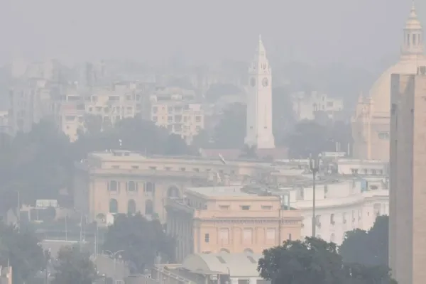
Cold Wave Alert: The weather pattern has been changing rapidly in Uttar Pradesh for the last few days. There is a continuous decline in day and night temperatures. According to the Meteorological Department, there is no active rain system present in the state at present, but the cold and dry north-westerly winds coming from the western Himalayan regions are cooling the atmosphere rapidly. Along with this, the clear sky further increases the radiative cooling during the night, due to which the minimum temperature has reached much below normal.
Due to the anticyclone formed over Central India, the downward flow of cold air from the upper level has increased. All these weather conditions together have created a significant change in the weather of the state. As a result, cold wave like conditions were recorded in many districts of the state, Etawah, Bareilly, Kanpur, Barabanki and Amethi last night.
Night temperature reached below 3 to 6 degrees Celsius
The Meteorological Department said that due to the current conditions, the minimum temperature is 3 to 6 degrees Celsius below normal. This situation may continue for the next 24 hours. On the basis of this, there is a possibility of marginal cold wave lasting till late night/morning of 16th November in the central areas of the state like Lucknow, Kanpur, Unnao, Rae Bareli, Hardoi, Barabanki, Amethi, Fatehpur, Banda etc. districts. However, due to sunlight during the day, the effect of cold wave gradually reduces and there is some relief even though the maximum temperature remains 1–4 degrees below normal.
Why is the cold increasing? Detailed report of meteorologists
According to meteorologists, the current cold has not come suddenly, but there are three main scientific reasons behind it –
- North-westerly winds coming from the western Himalayas
- These winds are generally cold and dry.
- Due to less moisture in the air the nights become colder.
- Clear skies and radiative cooling
- During the day, heat reaches the earth’s surface, but at night, due to the absence of clouds, this heat quickly escapes into the air.
- This is called “radiative cooling”, which rapidly reduces the minimum temperature.
Anticyclone formed over Central India
- This system pulls cold air from top to bottom.
- As a result the atmosphere near the ground becomes cooler.
- Due to the combined effect of these three reasons, cold has reached its initial form in the state for the last 4-5 days.
Weather will change from 17th November, there will be relief
The Meteorological Department has said that a change in the direction of the winds will be seen from November 17. At present north-westerly winds are blowing, but after the 17th, hot south-easterly or eastern winds will start coming. This will cause a slight increase in the night temperature. The partial cold wave situation going on in the state will end. Common people will start getting some relief from the cold.
Mist and light fog also possible in the morning
Due to low temperature, clear sky and fluctuations in humidity, there is a possibility of fog formation in the morning. Light fog may occur in many districts, reducing visibility to 500–800 metres. Although there is no possibility of dense fog right now, but meteorologists say that there will be a significant increase in fog from the last week of November.
Special advice for farmers, travelers and common people
- For farmers: Do not go to the fields during morning mist during wheat sowing. Light irrigation can be beneficial to protect crops from extreme cold at night.
- For passengers: Visibility may be reduced between 5–8 am, so drive slowly. Car drivers should use fog lights.
- for common people: Be sure to use warm clothes while going out at night and in the morning. Keep the elderly and children protected from cold winds.
Why is it so cold so early in November?
Climate experts say that compared to the last two years, this time cold has arrived sooner. There is a big reason for this.
- Premature snowfall in Himalayan regions
- lack of western disturbance
- dry environment
Due to all these reasons, Uttar Pradesh is beginning to feel December-like cold in mid-November itself.
In which districts the temperature dropped the most?
According to the data released by the Meteorological Department, night temperatures were recorded the most below normal in Etawah, Bareilly, Kanpur, Barabanki and Amethi. The severity of cold is more in the central and western districts of the state. The temperature is also going down rapidly in eastern UP.
Hospitals also issued advisory
With the increase in cold, the number of patients suffering from cold, cough, viral and asthma has started increasing. Many government and private hospitals have also advised people to drink hot water, avoid cold air in the morning and the elderly should not go out at night.


Why did Punjab Kings release Glenn Maxwell and Josh English? Head coach Ricky Ponting himself replied

Liam Livingstone released by Royal Challengers Bengaluru ahead of 2026 auction

South Africa beat India by 30 runs in Kolkata Test, take 1-0 series lead

South Africa defeated India by 30 runs in the first test, Proteas never lost a match under Bavuma’s captaincy.
